RENDER
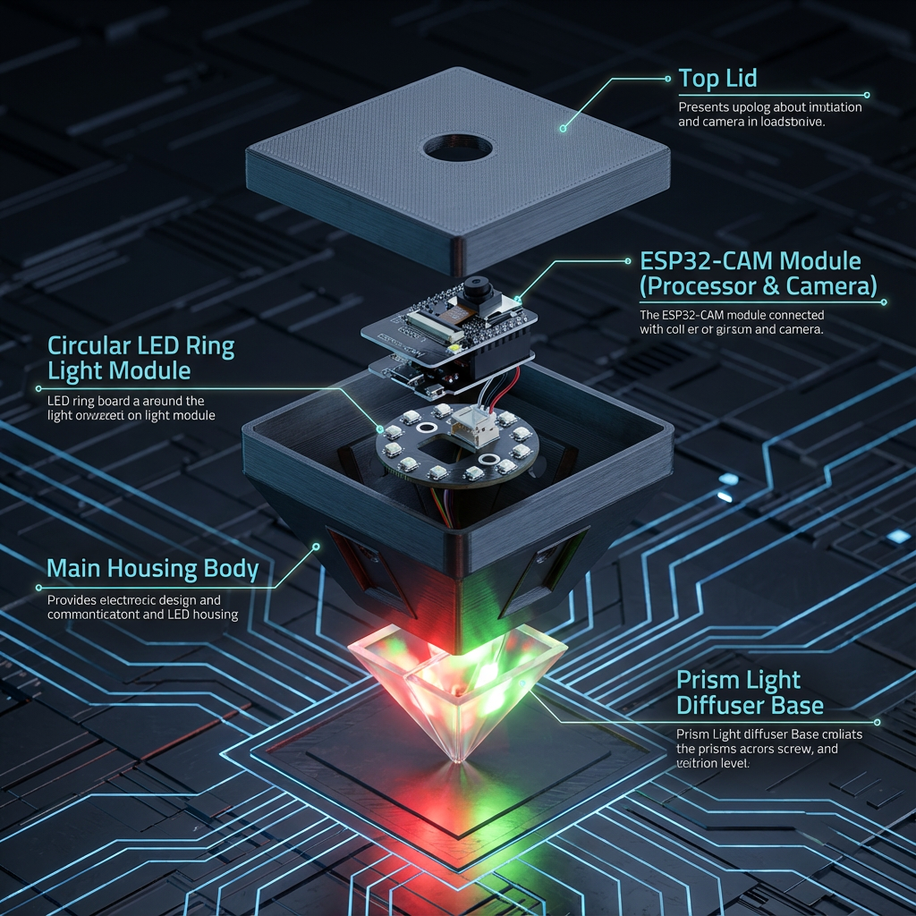
Parker ISPU Pyramid Node
Monitors six stalls and lane traffic for safe parking.
RENDER
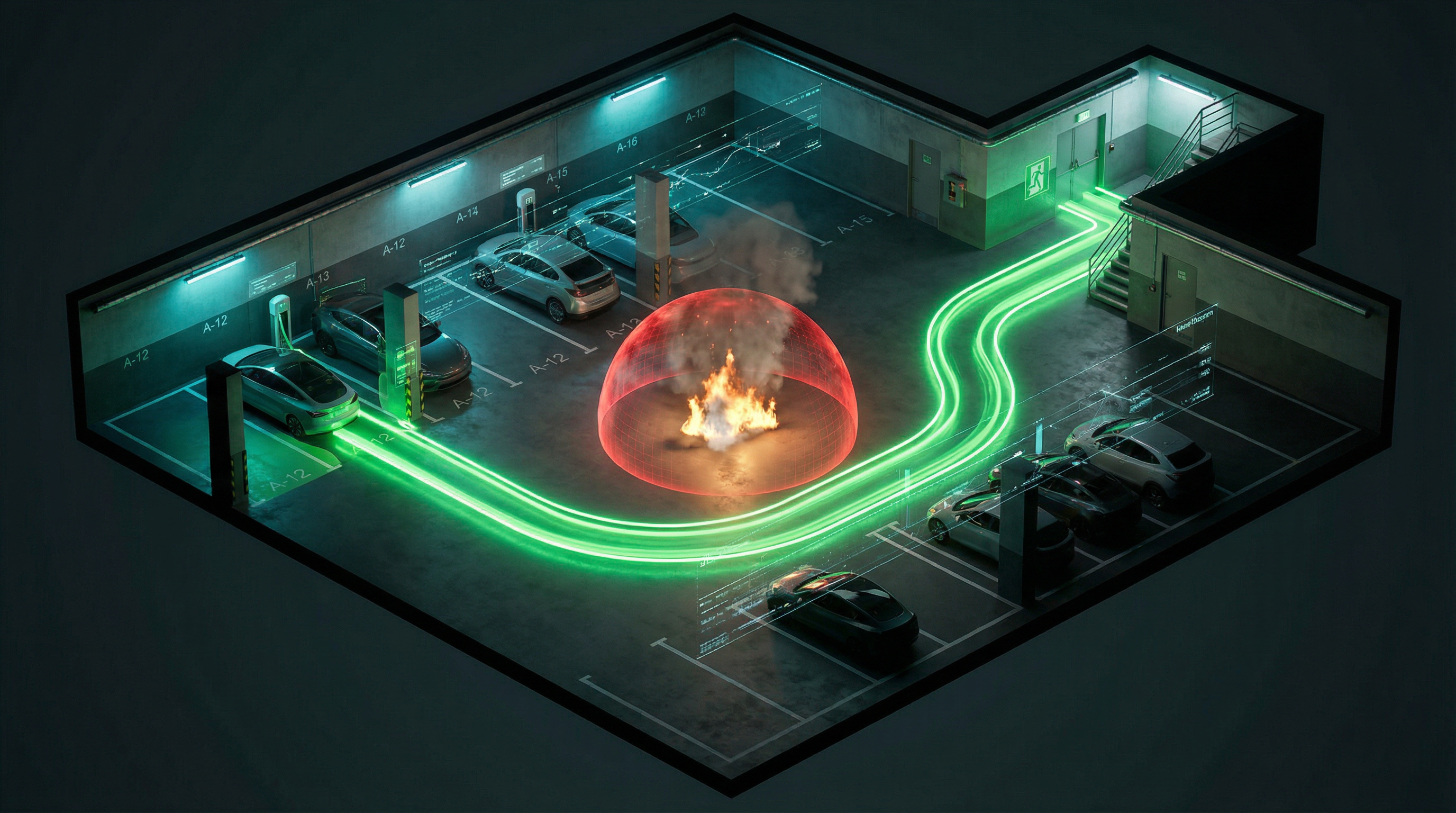
Dynamic Emergency Guidance Beacon
Dynamically computes the most effective evacuation paths based on real-time hazards.
RENDER
Camera Coverage Visualization
Visual representation of complete parking lot coverage with camera placement
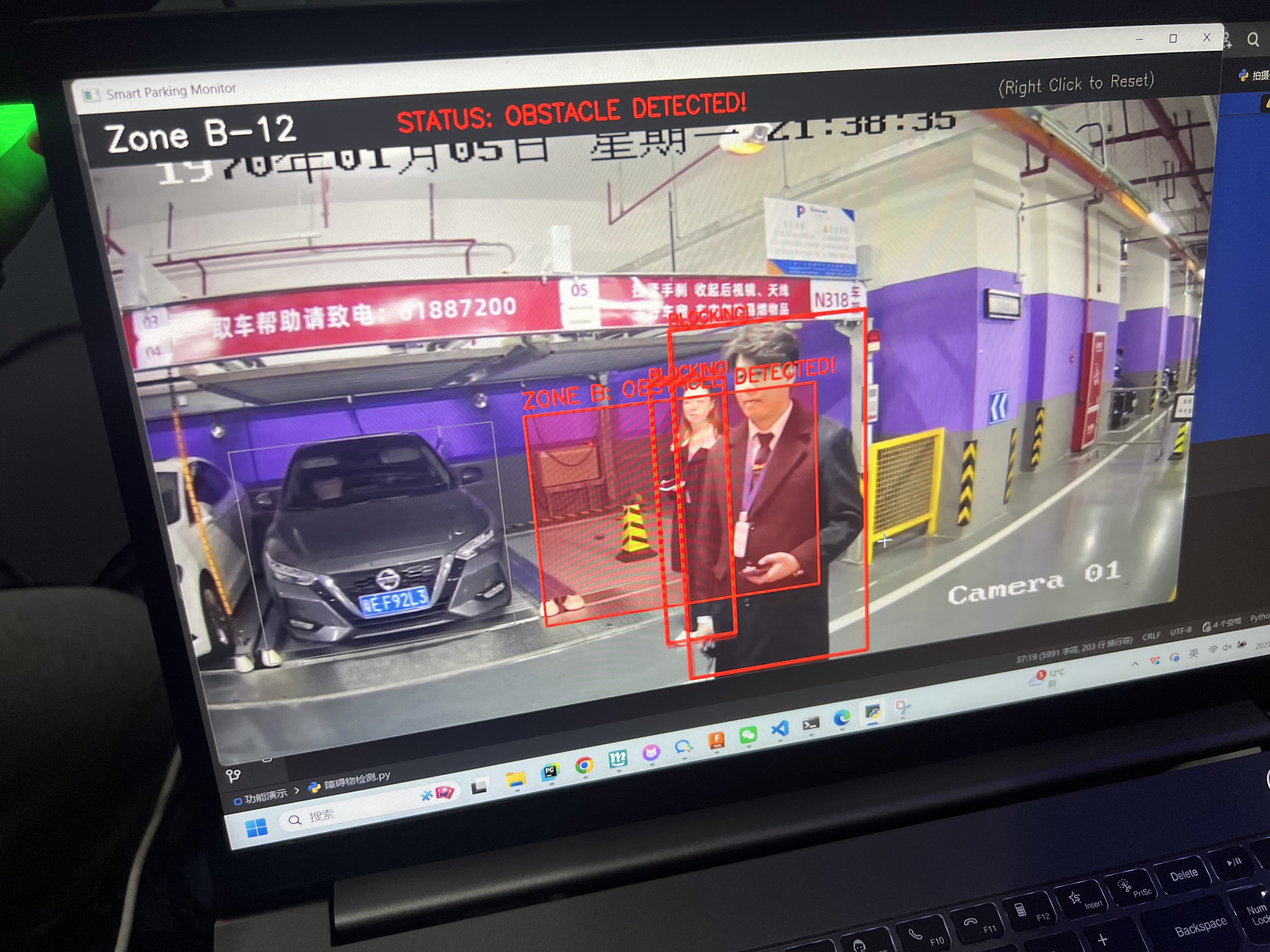
PHOTO
Real-Time Obstacle Detection Test
Validating lane-level obstacle perception under complex underground conditions.
PHOTO
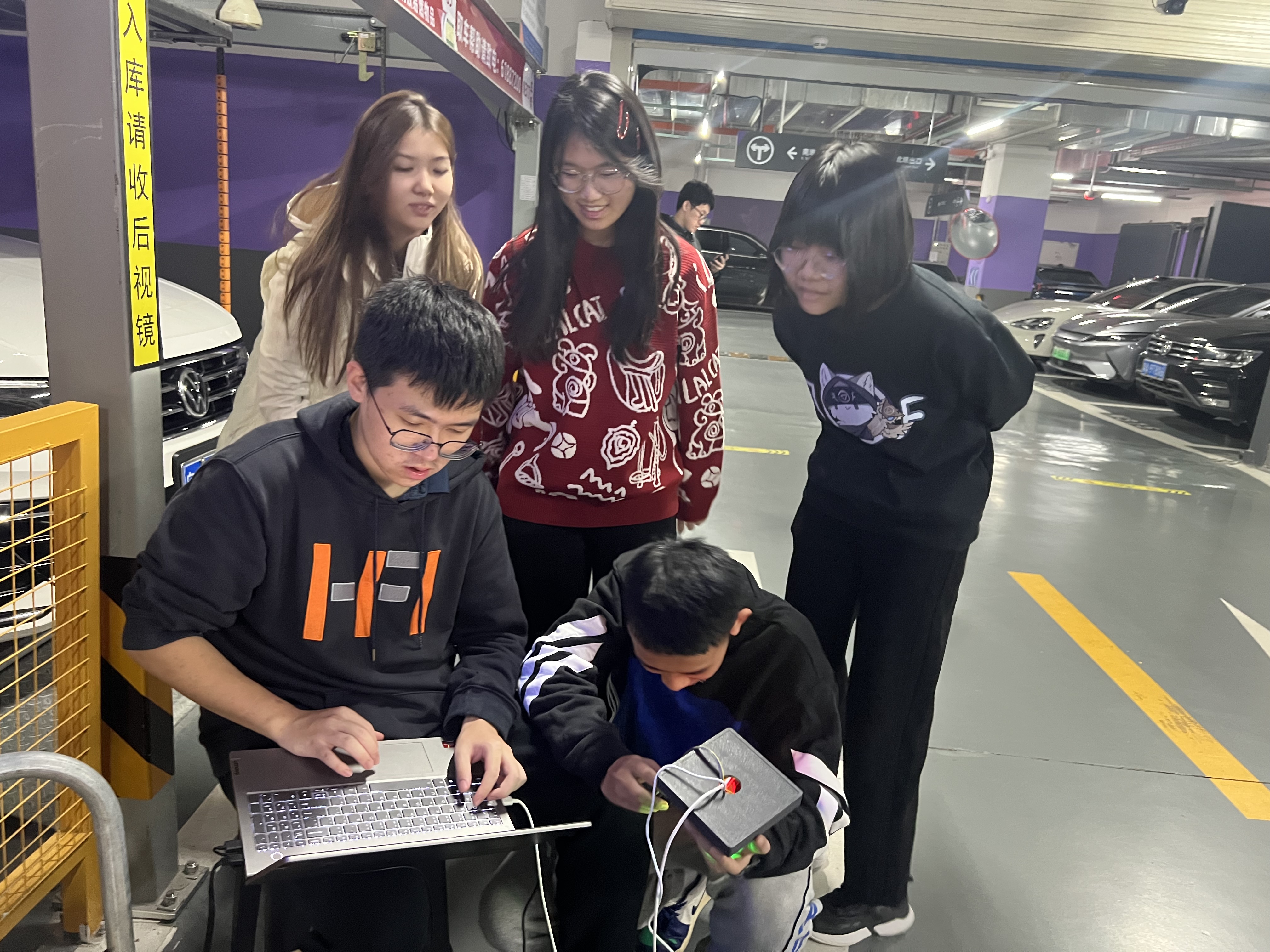
Vision Pyramid Hardware Calibration
On-site tuning of lane-centric sensing hardware for accurate perception.
PHOTO
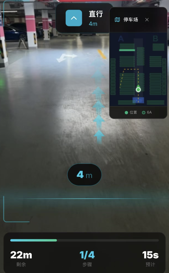
Digital Twin Vehicle Localization Test
Testing digital twin navigation for locating parked vehicles indoors.
PHOTO
Real-time Monitoring Dashboard
Control room setup showing live monitoring and management interface
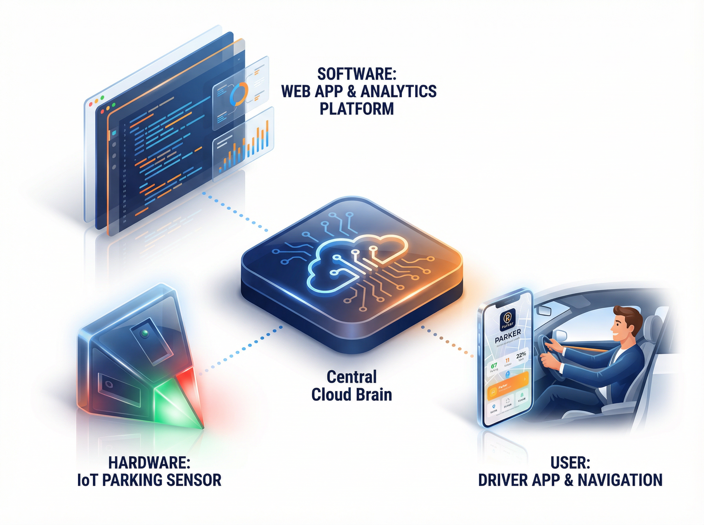
TOPO
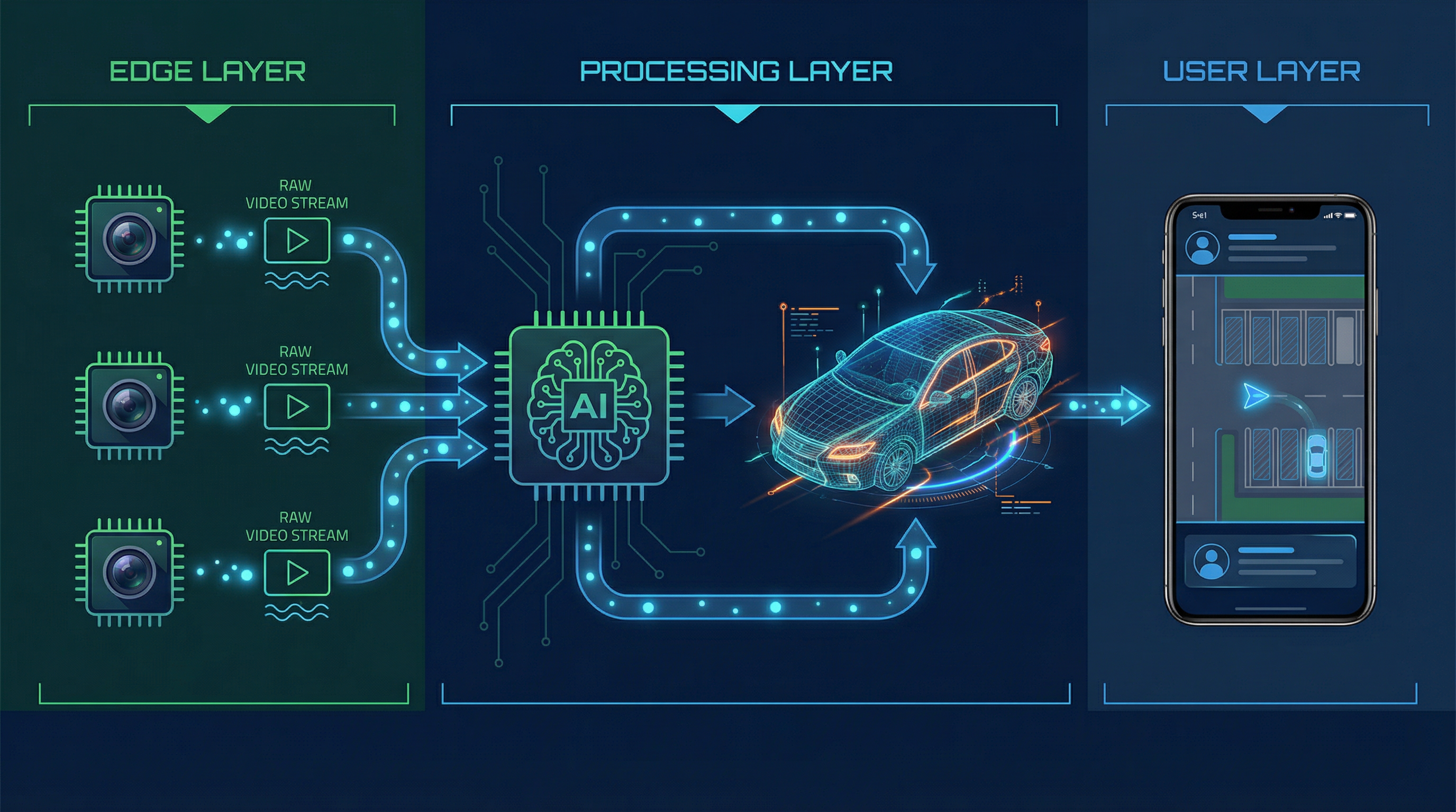
System Topology Diagram
Communication and Data Flow from Edge Devices to Cloud
TOPO
API Data Flow Example
Interface and Data Structure Diagram
TOPO
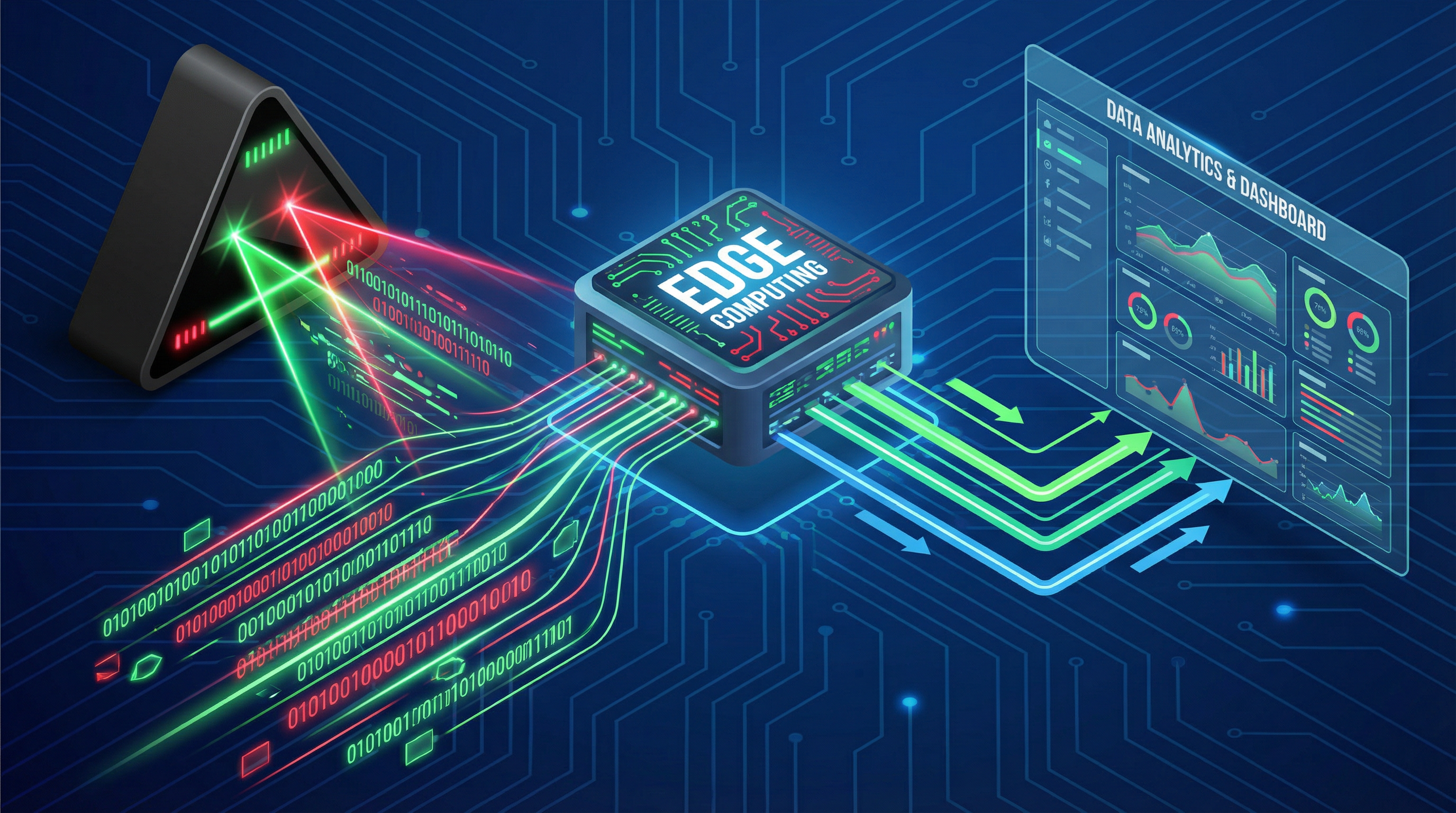
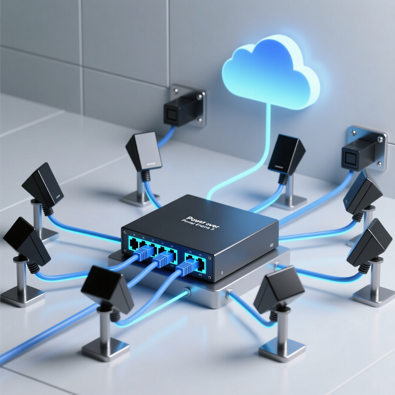
Network Architecture
PoE network layout and edge computing infrastructure design
TOPO
Emergency Response Flow
Laser guidance system activation and evacuation routing diagram